Call Us: +1 315 998 1998

A Japanese adage states, "Once a wise man, twice a fool," referring to individuals who climb Mount Fuji more than once. For locals, hiking Japan's most famous route is a kind of pilgrimage, but as tourists, we think there are other and better paths to take. The varied and beautiful landscapes of Japan are best explored with the help of a thorough Japan travel guide, which may point you in the direction of lesser-known but no less fascinating hiking paths and cultural activities.
rnOur Japan hiking experts have selected three areas with various challenging trails. They are a part of Japan's meticulously maintained walking network. They will lead you across the wooded island of Yakushima, along old pilgrimage trails and Samurai trading routes.
rnThe feudal lords of Japan had to make a long journey to Kyoto, the imperial capital, to pay their taxes to the Emperor in person. The Nakasendo Highway, 530 kilometers (330 miles) from Tokyo to Kyoto, saw the highest foot traffic. As a result, temples and ryokans (inns) sprung up along its length to accommodate tired travelers.
rnHighway stretches in the Kiso Valley, halfway between Tokyo and Kyoto, have managed to maintain their rustic 12th-century authenticity. Away from the well-traveled and crowded Magome-Tsumago stretch, I established myself in Kiso-Fukushima, one of the Edo-period trade towns.
rn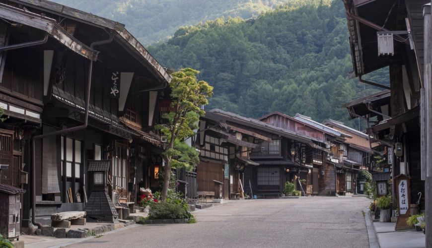 Narai
Narai
I recommend traveling the four miles (6.5 kilometers) between Yabuhara and Narai, north of Magome-Tsumago. You may take a train from your ryokan to the trailhead and then return to Narai after hiking this peaceful portion. If you're in the mood, you can keep going down the road to the next stop.
rnOnce you reach Yabuhara, follow the river as it winds through this ultra-contemporary Japanese city until you find yourself in a semi-alpine forest. From here, a cobbled forest path takes you past Shinto shrines, hamlets, and the odd bear bell; the Japanese sometimes carry little bells that jingle linked to their bags.
rnThe trail is well-marked and somewhat steep as it ascends to Torii Pass, from which you can see across the valley. Statues of doujin (guardian deities) may be seen here, at one of the route's most remote points for hikers in the Edo era, protecting against thievery and poor weather.
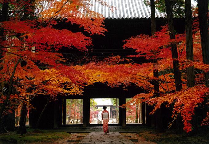
rnNarai, once the valley's most prosperous post town, is located below the pass. Beautifully preserved wooden buildings from the Edo era line the main street, and there are plenty of places to stop for a dorayaki (bean curd pancake) after your stroll.
rnKiso-Fukushima's modest, family-run ryokan is a significant selling point. Onyado Tsutaya is a wooden-fronted inn in the heart of town with hot steam baths and tatami mat flooring. The kaiseki supper, which consists of several little dishes, is one of the best in the world. Pheasant, beef, pig, and pickled vegetables are typical dishes in landlocked regions.
rnAs the wolf goddess prowls below, tiny, opaque Kodama (forest spirits) peep inquisitive faces through the moss on the trees in the Japanese anime classic Princess Mononoke. Yakushima, an island off Japan's southern coast, inspired this ethereal animated fantasy realm.
rn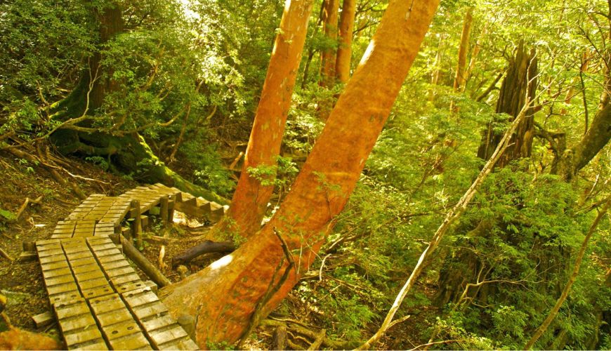 Walking trail, Yakushima Island
Getting to the island is like traveling to a different world. I boarded a hydrofoil at Kagoshima, although arranging flights can be challenging due to frequent delays. I boarded a hydrofoil to my destination. After passing the volcanic volcanic volcano Sakurajima in Kagoshima Bay, you will finally reach the open sea. Yakushima appears on the horizon as the mainland fades away. It seems more like the Caribbean than Japan, with its rounded golden beaches, turquoise water, and forested hills.
rnYakushima is a cluster of national parks protected by UNESCO and surrounded by a small town with a few hotels and eateries. Shiratani Unsuikyo should be your top park choice if you can only visit one. From the park's main office, three paths wind down the bottom of the ravine and eventually disappear into the canopy-hiding woods beyond. The neat sidewalks of the Nakasendo Highway are a long cry from the treacherous tree roots and lichen-covered rocks that you must climb over to reach the neighboring waterfall.
rnOne to four hours is the typical travel time. The well-marked trails make it easy to follow them, and nothing artificial detracts from the unearthly atmosphere. The longest path is 3.4 miles long and well worth the effort. The uncommon liverworts, hornworts, and more than 700 species of moss that cover the forest floor create a verdant veil over the landscape.
rnYou may come upon a yaku sugi here and there as you make your way through this virgin woodland. During the Edo era, when islanders paid their taxes on wood, the authorities cut down thousands of these old cedar trees. All the surviving trees, including the twisted Jomon Sugi (called after a time of Japanese antiquity), are fondly known by their given names. The authorities cut down some trees as big as homes, and you'll see plenty of their stumps along the way. Ernest Henry Wilson, a British naturalist, was the first to study the area around Wilson's Stump.
rn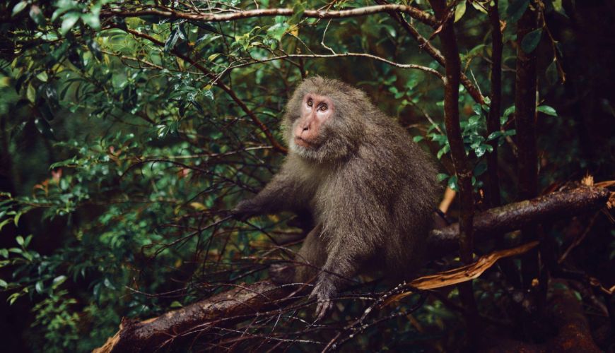 Yakushima macaque
Public transportation in Yakushima is restricted, which is rare in Japan. Therefore, I recommend renting a vehicle to maximize your stay there. Japanese drivers are notoriously cautious and take their time, even if the roads narrow considerably inside national parks (all of which have car parks). Yakushima macaques sometimes gather in groups to have family reunions in the middle of the road, but if you wait patiently, they will eventually unwillingly leave the area.
rnrn
rn
Relax at the Sankara Hotel & Spa with an outdoor bath that your butler has prepared after a strenuous day of hiking. The eight-course tasting menu at supper and the scalp massage offered by the hairbrush in your bedroom indicate the high level of service here.
rnrn
Cottage Morinokokage offers simple wooden cabins for those who want to experience true isolation on the island. It's almost like glamorous camping with the hammock beds and minimal decor. You may enjoy the evening breeze and the shade of the trees from your front porch as you grill.
rnrn
rn
By Alice
rnrn
The mountainous territory of Kumano has long been a destination of devotion due to its associations with Yomi-no-Kuni (the legendary country of the dead) and as a doorway to the Buddhist heavenly paradises. People from all walks of life in Japan have been making the pilgrimage to the Kii Peninsula in the south to visit the three Grand Shrines there for over a thousand years. A network of pilgrimage routes known as the Kumano Kodo currently defines this mountainous area.
rnrn
The Imperial Family often used the Nakahechi route. Between Takijiri-oji and Kumano Hongu Taisha, another of the Grand Shrines, is a string of Oji shrines where visitors may make gifts and undergo cleansing rites on their way to the final destination. While many shrines include elaborate structures like torii gates and pavilions, others may have a single stone or statue to commemorate their location. Even though I encountered very few other hikers, this is the most popular path.
rnrn
There is no need for a guide if obvious signs are pointing the way. If you decide to deviate from the official trail, you will quickly find a sign that reads "not Kumano Kodo." You may avoid walking the entire 40 km (24 mi) distance on foot thanks to a network of transport connections along the way. On day two, I elected to cut out a segment that was 8 kilometers (5 miles) long and was now a paved road.
rnrn
The path is more remote than the Nakasendo Highway and climbs steeply through a forest that blocks much sunshine. Oji shrines are frequently distinguishable by their distinctive wooden Torii gates. Occasionally, I'd hear other hikers ringing the bells at the shrines. You'll go past this peculiar little cluster of homes and are welcome to stay for tea.
rnrn
Kumano Hongu Taisha, a Shinto temple with tiered pavilions, is the last stop along the Nakahechi itinerary. The builders used organic materials and complex no-nail couplings to construct it, fitting it to its natural setting.
rnrn
After your two-day trek, you may visit Hayatama Taisha and Nachi Taisha by boat down the Kumano-gawa River and mark them off your list of Great Shrines (you're not cheating; most pilgrims did this).
rnrn
rn
rn
rn
rn
rn
Many little towns have developed along the route's most significant shrines. Around the midway point, Chikatsuyu is a great place to spend the night. I stayed in a tiny, old-fashioned ryokan down by the water. Yunomine is an onsen town, so you may remain there after the trek and rest your sore muscles in the hot springs.
Start thinking about your experience. These itineraries are simply suggestions for how you could enjoy some of the same experiences as our specialists. They’re just for inspiration, because your trip will be created around your particular tastes.
Start thinking about your experience. These itineraries are simply suggestions for how you could enjoy some of the same experiences as our specialists. They’re just for inspiration, because your trip will be created around your particular tastes.
Tell us about your plans and one of our specialists will plan a unique trip for you…
Can’t get any ideas for you next trip? Let TripAdvisor help you!

Find something else special